Wednesday, July 31, 2013

Approaching Eyjafjallajökull

Approaching Eyjafjallajökull - July 30


Leaving Kirkjubæjarklaustur the road turned southwest across an old lava field and then across Mýrdalssandur, a similar sandy floodplain as I´d crossed the previous days, now only south of the volcanos like Katla under the glacier Mýrdalsjökull. Not too long after starting, I caught up with an Austrian couple, Andreas and Sabine, that were heading to Vík for the day. We rode together for a few kilometres chatting about this and that. They had been touring Albania the previous summer and go on a trip almost every year! When I stopped for lunch later on, it was in a quiet little spot next to a creek not far from Þykkvabæjarklaustur. I learned the story of Katla, a witch that gave name to the volcano not far away. She had a pair of magic breeches! They would lend her the strength of running as far as she'd like without ever getting tired. I wish I had a pair of those! She once killed a man who borrowed them without her permission, so that he could gather all the sheep in the fields before the farmer came home! The rest of the way to Vík was rather quiet, passing all the lupines that had been planted in the sands to prevent erosion and keep the sand from building up on and closing the road. At Vík there was the first real climb in several days and once over that the landscape changed completely. Suddenly I was cycling through farmland with high cliffs on the right to the north, that used to be sea cliffs long ago before the sea receded. It was cloudy also, but once I got closer Eyjafjallajökull poked out of the clouds momentarily so I knew I was getting close to my stop for the night. I pulled in to Skógar at about 7pm, with plenty of time to eat, set up camp and have a look at the majestic Skógafoss before heading to bed.

Cycling through the "Hraun" by Mýrdalssandur

Eyjafjallajökull poking out of the clouds
My campsite by Skógafoss


Tuesday, July 30, 2013

Jökull this Jökull that

Jökull this Jökull that - July 28


Sunday means Icelanders sleep in so the supermarket didn´t open until 12 o´clock. No matter though since I like to sleep in also. BUT! This meant I missed the nice weather in the morning and had 5-6 hours of rain during the afternoon while I was riding. It was flat and the wind was in my favour though, so it was nice cruising along the coast, with a beautiful view of the mountains and the glacier outflows to my right. Everything so well coordinated, the names of the mountains corresponding to the names of the glaciers and the rivers and also the farms. I had already gone 40 miles before I stopped for dinner, a miserable affair in the rain, but tasty all the same. I later learned that the area I was passing, Suðursveit is one of the wettest parts of Iceland so I'm at least glad I got to experience a typical Suðursveit day! I got to Jökulsárslón and had to stop to see the icebergs. Explaining the icebergs, the glacier Vatnajökull used to be a lot smaller when settlers first arrived, but grew a lot until the late 19th century and is now slowly receding again. The receding glacier has left behind a lagoon where parts of the glacier breaks off to form icebergs floating around with the tide. The tide was coming in as I was there so I saw massive chunks of ice crashing into each other, some breaking apart and flipping over, really cool to watch! Once I left the lagoon and started heading towards fjallsjökull, I got my first proper tailwind of the whole trip and really started flying. I was going at least 15mph (24km/h), but at times up to 22mph (35km/h) even on the flats with a fully loaded touring bike! Compare that to my previous average of about 11mph (17km/h) and going about 19mph (30km/h) in the ironman. As I turned around Öræfi, where Iceland´s highest mountain is found, the rain also stopped and although wet and cold I finished the last 25km to the national park at Skaftafell. I took down some bread and cheese for a quick dinner, quietly set up my tent and went to bed amongst perhaps 100 other tents with other travellers.

Leaving Höfn - first distance marker back to Reykjavík!
Cold and wet by iceberg lagoon
Arrived to Skaftafell!

Crossing the sands - July 29


The sun was out when I woke so left all my gear behind and headed out for a hike through the national park to see Svartifoss. I remember it as well from 20 years past, but it was more beautiful than I remember! Black basalt columns create a spectacular backdrop to the waterfall, which with little surprise reminded me a lot of Hallgrímskirkjan in Reykjavík. Later on the hike I met some volunteers from Britain the US and the Netherlands who were fixing the trails as part of the Iceland Conservation Volunteers group. Not a bad way to spend a summer, traveling Iceland and working for a while in the national parks! Back at the visitors centre I read about the volcanic eruptions in 1362 and 1996 under Vatnajökull. It was interesting to read about the one in 1362 because basically the whole area I had cycled through the previous day had been covered in ash and pumice and later flooded during the eruption, destroying farms and killing hundreds. In 1996 there was another massive eruption which flooded the plains below the glacier. The floodwaters were equivalent to a river larger than any on earth except the Amazon. It destroyed the highway connecting east and west, washing way the bridges that had only been built in the 70´s finally connecting the Öræfi region to the western part of Iceland. Leaving Skaftafell I stopped only about 2 miles out at a memorial to those floods, with a massive piece of mangled steel from the destroyed bridge on display. But just as I got off my bike, another cyclist pulled up who I recognised from earlier in the trip when climbing Öxnadalsheiði to Akureyri! It was Scott, an American with a bushy white beard who I had also heard about from the British cyclist Dan that I spoke to at Mývatn. Scott was on the last few days of a 5200 mile tour that started in April of Ireland, Scotland, Norway, the Faroes and Iceland! It was terrific talking to him, he said he would do a tour like that every 5 years, while going on long hiking or kayaking trips the other years. We talked for about 45 minutes before he took off to take advantage of the tail wind that had picked up. Unfortunately that meant that I was going into the wind on my way east. It was quite tough, as I was crossing the desolate sands and floodplain of Skeiðarásandur with a long straight road ahead of me and the wind in my face. Fortunately it was sunny, and I had a shorter ride this day so it wash´t long until I had crossed the sands and had about 15 miles before arriving to Kirkjubæjarklaustur. Arriving at the campsite I saw several people that I´d seen on the hike earlier in the day at Skaftafell, and even a Romanian guy I had spoken to briefly in Sauðarkókur about 10 days earlier. It's quite amazing how small the world can be, especially when travelling and having the time to observe and meet people!

Selfie at Svartifoss
The beautiful Svartifoss
Meeting Scott - beards unite!


Monday, July 29, 2013

Food! Skýr and Hangikjötssalat!

Food! Skýr and Hangikjötssalat!

I haven´t written anything yet about eating on the road so I thought I´d change that. Mostly I have Skýr with muesli for breakfast along with some rye bread and cheese. My aunt also introduced me to something called Hangikjötssalat, a wonderful blend of mayonnaise, smoked lamb, green beans and carrots that one spreads on bread! Amazingly delicious! I´ve also been using my JetBoil stove quite a bit to make soups or prepare some pasta dishes, blending in some chopped veggies like zucchini or broccoli. Not to forget also, that I´ve been eating outrageous amounts of chocolate on the road too, almost half a pound per day and then also copious amounts of chocolate covered raisins. I´m starting to miss the fresh greens from the Last Organic Outpost in Houston!

A typical lunch time meal - pasta with zucchini and some hangikjötssalat on rúgbrauð!
Hangikjötssalat - pure deliciousness


Fog Fog and more Fog - July 26


This time around, the sun had disappeared in the morning and been replaced by a dense fog that filled the entire fjord. It was also a bit chillier at around 10C which was a nice change. Leaving Reyðarfjörður there was a 6km long tunnel to the next fjord. It was newer and wider than the one by Ísafjörður and with less traffic. I stopped halfway and waited for a bit, contemplating in the silence that there were 3km both ahead and behind me out of the mountain and at least 1000m of rock on top of me! It was an eerie but really cool feeling, like being a mountain troll! The next fjords were easy riding, with hardly any significant rises, just undulating ups and downs. In fact, I used my gears much more than in previous riding as the road would go up and down every couple of hundred meters. The fog remained though so although there was fine visibility on the road I unfortunately couldn´t see any mountains or scenery. Arriving to Stöðvarfjörður after about 45km I passed a curious sign saying "Steinasafn Petru" or "Petras Stone Museum". I´m so glad I stopped because it was a wonderful museum of Icelandic minerals built on the personal collection of Petra Sveinsdottir. She was a woman born locally in the fjord who throughout the course of her life had built up an exceptional collection of different rocks and minerals including Obsidian, Icelandic Spar, Opal and more. It was all set in a beautiful garden with incredible flowers proving that even in Iceland you can have a colourful garden. There were also examples of eggs from different local birds, and also collections of playing cards, handkerchiefs, keychains and pens! The boy who sold me the entry ticket was also Petras great-grandson. After having spent more time than expected in Stöðvarfjörður I tried to hurry on and although the road was good it got quite late and I didn't quite make it to Djúpivogur as I had hoped, but found a nice camping spot on the side of the road about 6 miles out from town.

Petras rock museum and garden
A rock used as a seat for kids with pictures of the lucky little ones!
Foggy evening at Berufjörður


Black beaches and lagoons of Swans - July 27


With the ever changing Icelandic weather, this morning brought back the sun and the fog was drifting away revealing staggeringly high mountains all around me! As I was breaking down my tent I saw a family cycling south on the road who I later caught up with. They were a family of four from Belgium that had crossed Iceland through the interior at Kjölur, a very tough ride! They had a lot of experience touring also in France, Czech republic, Italy and other places, and were happy to share some stories. It was fun meeting some other cyclists again, but they were taking a more leisurely pace so I passed them and continued on. The scenery in the next fjords was beautiful, not with quite the dramatic rises and cliffs like in the West, but still incredibly beautiful. I had lunch at a place called Þvottá (Washing River) and it turned out to be the site of the beginning of Icelands conversion to Christianity, where the first baptisms had taken place. Despite my fondness of the Aesir gods, it was cool that even on such an unremarkable stop at a little picnic table it turned out to be such a historically significant site. Riding along towards Hvalnes I passed a stunning beach of black rocks and once turning the bend towards Lónsvik I had to stop at the Hvalnes lighthouse to admire the view! It was very peaceful there, sitting listening to the waves crashing and looking out across at the ominous mountains across the bay near my destination for the day, Höfn. As I continued along the bay I passed a lagoon where there must have been at least 300 swans lazily floating around and feeding. It was an incredible sight and I stopped briefly to pick out some beautiful swan feathers left on the shore. The sun grew stronger in the late afternoon and the rest of the ride was very pleasant and quick. Passing through another short tunnel I arrived to Höfn to a stunning sunset. After setting up my tent I went into town to admire my first view of Icelands largest glacier, Vatnajökull. The ice in parts seemed to flow all the way down to the shore and reflected the dying sunlight beautifully. No wonder one of Icelands most famous artists Svavar Guðnason got much of his inspiration from the natural surroundings of his home town Höfn. I took too long admiring the view though, so the restaurants were all closing in town and I had to resort to another meal of a burger at the local N1 rest-stop near the campgrounds. I´ll just have to wait for a good meal and a beer until Selfoss or back in Reykjavík!
Two Belgians cycling up the road near Djúpivogur
One of the many single lane bridges in Iceland - this one at Hofsá in Álftafjörður

A bouquet of Swan feathers in Lónsvik!

Sunset at Höfn with outlet glaciers from Vatnajökull nearly touching the water


Saturday, July 27, 2013

Crossing Fjöllum

Crossing Fjöllum - July 24


With the late night adventures the previous night, I again found myself not getting started until about noon. I packed up quickly and headed down to see Dettifoss before taking off for the days ride. The rumbling only got louder and louder with the approach, and suddenly it was there. I remember being astounded when I first saw Dettifoss in 1993, but it was even larger and more impressive than I remember. After staring into the hypnotising masses of water tumbling down and taking some photos of the double rainbow created by the sunny day and the large amounts of mist, I got back on my bike and set off for what I knew was going to be a very long day. The wind was in my back for maybe the first 10km but then that was over and I was struggling in low gears for the rest of the way. The first 40km or so was through a barren landscape, mostly rocks with a few patches of grass here and there. I crossed the Jökulsá a Fjöllum river over what must be the only suspension bridge in Iceland, and it really felt like I was about to cross a dry, unpopulated desert. I had been warned that there wouldn´t be any place to get water between Mývatn and Egilsstaðir, and I had about 4 liters with me just in case. However, after leaving the basin by Jökulsá there were plenty of little creeks. It seems that the only truly dry stage of my ride was by Dettifoss. With the strong wind though, I had to drop the chain into the granny ring even on the flats and as my legs were still feeling the previous days ride, I decided to seek refuge behind a large mound of gravel and take a nap. That moment was the closest I´ve felt to quitting on the whole ride! But I was dozens of miles from anywhere so after a brilliant hours nap I pulled myself together, got on my bike and meter by meter slowly continued up the mountain into the wind. With the setting sun in the northwest I continuously had my shadow to keep me company on my right, it was nice having a partner climbing the same mountains even though it was only my shadow! After about an hours climb I found myself in Langidalur which turned out to be the highest portion of the entire route. I could see more mountains to the east and worryingly some large dark clouds. Out of the valley I reached the junction with the road to Vopnafjörður and read on a sign that I was near the area that had inspired Halldór Laxness to write "Independent People"! Very interesting since I´m about to re-read it! After a while riding through a calm beautiful flat area I started descending to what I knew was Jökuldalur, but I was enveloped by the fog that I had seen earlier as the dark clouds, and could now hardly see a thing. I continued as long as I felt safe and set up camp on a patch of grass near a waterfall coming down the side of the mountain. On a curious note, I realised as I went to sleep that I had not spoken to a single person the entire day and not set foot inside of a building either. A strange solitary but wonderful day!

The rainbow at Dettifoss is coming out my beard!
The hypnotising waters of Dettifoss
My refuge from the strong headwinds and site of a great nap
In Langidalur, highest portion of the ring road!
Descending into the fog

Arriving to the East Fjords! - July 25


Today I truly felt that I had left the most difficult parts behind me, and was eager to restock in Egilstaðir and see the ocean again in the East Fjords! The fog from the previous night had burned away with the sun, and I continued down the valley which turned into more like a gorge towards the end. After one more steep climb and a pleasant 20km more down to Egilsstaðir I picked up some groceries, and veered off the ring road that takes a more direct route, and instead went east to the fjords. Again, I thought I had left the difficult parts behind me but I should have known the wind was going to come from the east straight through the valley I was climbing. I had to deal with some newly paved roads with loose gravel, but the valley was stunning and I was glad to be back in an area the reminded me of the west fjords. Arriving to Reyðarfjörður I had gone 50 miles but I was tired and eager for a hot shower so I found the campsite and set up my tent. After a hot shower and changing into clean clothes I walked into town to find a place to eat. The women´s Euro Cup was on tv so I watched Norway defeat Denmark in the semis, while I enjoyed another burger and Egils Appelsin. Back at camp I had a long conversation with two Germans, one only 19 and the other already retired. It was fun speaking German, and hearing about their very different lives, especially since one was just heading out into adulthood and the other had left work behind and was now traveling the world. I also spoke with some Icelanders, who were surprised I could speak Icelandic. It turns out that I look foreign, but it´s great to be able to connect with people in their language and as such I found out that this particular Icelander was from Akranes that I had passed on my first day, but whose family was from Dýrafjörður just next to where my familys origin! I went to sleep late, but it had been a fun evening and it was great to be back by the coast!

My camp site in the morning when all the fog was gone

First glimpse of the Atlantic since Akureyri!

Beautiful surroundings in Reyðarfjörður


Thursday, July 25, 2013

The Lake of Midges and the Whispering Cliffs

The Lake of Midges - July 22


Monday morning! With fresh legs after sleeping two nights in a bed, I went into town to get supplies and then head out of Akureyri. I made sure to stop first and get a Þór jersey from the local football club. Þórsarar! Þórsarar! It was a slow departure because the view of town was incredible from across the fjord. Plus there was a steep climb to make it across into the next valley which was absolutely beautiful and green in the sunshine, with a swollen river running through it from all the snow melting in the mountain tops. The road then turned east, and that is when I met the wind again which I would have to battle for the next several days. The road was relatively flat but lots and lots of wind, all the way through the town of Laugar until I got to Lake Mývatn. I learned a new word too, two in fact. Mý is Icelandic for Midges. A type of small fly from which the lake takes its name. Once arriving at the lake I had to ride around it to get to the town with the campsite. Mývatn is a protected area so there isn´t any wild camping allowed. It was a wonderful hour long ride or so, with one of the highlights being a group of 25 ducklings that all scuttled away as I biked past. Mývatn is also a great place for birds, apparently it makes for a great breeding ground for many bird species :) The camp site I arrived at was very different from what I´d seen before, SO MANY tourists! There were Germans, Italians, Frenchmen, and maybe a few Icelanders. Very much a hotspot for backpackers. It was fun hearing so many languages spoken, and hearing the chatter about the previous days adventures
and plans for the next!
Leaving Akureryi - what a great place!
Goðafoss - the waterfall of the Gods, halfway to Mývatn
Sunset at Lake Mývatn - as seen from my tent

Hike into a crater and Whispering Cliffs! - July 23


I got an early start as I wanted to climb a nearby mountain before heading out, so I biked about 5km to Hverfell and jogged up. It wasn´t a very high mountain but the view was spectacular! Both out across the lake and the colourful hills to the north, but also into the crater of the extinct volcano. Absolutely amazing! Once back to the campsite I packed up, but also spoke to an American woman traveling on her bike, and Englishman who was about to cross Icelands interior by bike, and two Spaniards from Barcelona (who I got to speak in Spanish with) who seemed a bit unprepared because they were complaining about getting soaked in the rain without proper gear! They were in high spirits though, all smiles! So I didn´t leave Mývatn until 2pm, and there was plenty more to see. I had only made it about 6km when I got to Námafjall and stopped to look at the boiling mud pots and inhale big gulps of Hydrogen Sulphide! It was really cool to see geothermal activity in action! I also learned that they used to mine for sulphur there to be used for gunpowder, which almost caused a war between Denmark and Sweden in the 1560´s. Sweden had even considered attempting to conquer Iceland from the Danes! When I finally continued, I again had to head straight into the wind. It was strange, because it was an easterly wind for the first 20km, and when I turned north towards Dettifoss it was suddenly a northerly wind! I arrived at about 6pm and set up my tent at a great hidden camping spot beyond the main parking area, where only a couple of other hikers were set up. The park ranger also brought water every day so it was a great spot! 
Ég up on top of Hverfell
The bubbling mud pots at Námafjall
Disregarding the snow in the mountains, this looks more like west Texas to me than Iceland!


Midnight hike and mountain biking

After a quick snack I thought I´d go on a short 24km ride up to Hljóðaklettar (the Whispering Cliffs), and make it back early enough. However, the gravel roads in eastern Iceland are not quite like those in the west. I´m very glad I had a sturdy bike, because even though I wasn´t carrying any gear, it was extremely slow going over a beat up road with lots of sand and deep gravel that would make me fish tail every so often. After what seemed like an eternity I finally made it and it was completely worth the ride. The cliffs that had been exposed by erosion from major flooding of the Jökulsá river were unbelievable! Worm like shapes frozen in the rock, and tall basalt columns rising out of the ground. Caves as well, with the roofs taking on a honeycomb pattern. By the time I had hiked around the area for probably two hours, it was already midnight, and across from the red glow of the sunset, a full moon was rising. It kept me company all the way back to Dettifoss, through another couple of hours of bone-rattling rough cycling. I still had to eat dinner once I got back, but crawled into my sleeping bag by 3am, and then fell asleep to the rumbling of the Dettifoss waterfall that I was to look at the next morning!
Karl go Kerling at Hljódaklettar - two trolls trapped in stone
Honeycomb rocks at Hljóðaklettar
Full moon keeping me company along the bumpy ride back to Dettifoss

Sunday, July 21, 2013

Akureyri - Capital of the Bright North!

Rejoining the ring road

I finally got an early start! Early enough being that I was all packed up and headed out by 11 o'clock! Now that I've rejoined the main highway 1 or the ring-road, my pace is a lot faster and in no time at all I had made it across to Viðidal, a beautiful wide valley with tall mountains to the east. Once I reached those mountains and turned north, the clouds behind me had hit the mountains and the rain started coming down so for a brief while it was wet and extremely windy where I had to get off my bike and wait for a bit so I wouldn´t risk steering myself into the road to compensate for the wind. There was quite a lot of traffic today, with most seemingly making an early start to the weekend. At Blönduós I stopped for lunch and filled up with water, before turning off the main road again to head towards Sauðarkrókur. 
Watch for sheep!

Sauðarkrókur

From my first trip to Iceland in 1993 I remembered Sauðarkrókur as this wonderfully beautiful place that was very sunny, and the name of the town somehow always had made me think of frogs… maybe krókur, and the Swedish word for frog ´groda´ sound similar? It was nice being off the main road again, although there was a big rise to go over. It seemed to end too soon though, as the road dropped into another small valley before going up again and then finally down to Skagafjörður where Sauðarkrókur lies. It was great arriving to town at a reasonable hour (before 7pm) and I got to the camp site with enough time to talk to the owner for a bit, and relax for a while before heading to bed. In the morning I spoke to a Canadian woman Wendy who was also on her bike, although she was only traveling around the north. She told me about her tour to New Zealand where it was common for the locals to go on epic walks across the country, and where she had worked at a walnut farm! It´s a great conversation starter traveling by bicycle, most everyone is curious and like to talk. After packing up I made sure to stop a the local tannery, another reason why I had made the small detour to Sauðarkrókur. This is where all the animal skins from Iceland are processed into leather, especially fish skins. It was amazing seeing all the different colours and textures of the fish leather, from salmon, ocean perch and wolffish. They also sold sheep skins and even from skins horses and seals.
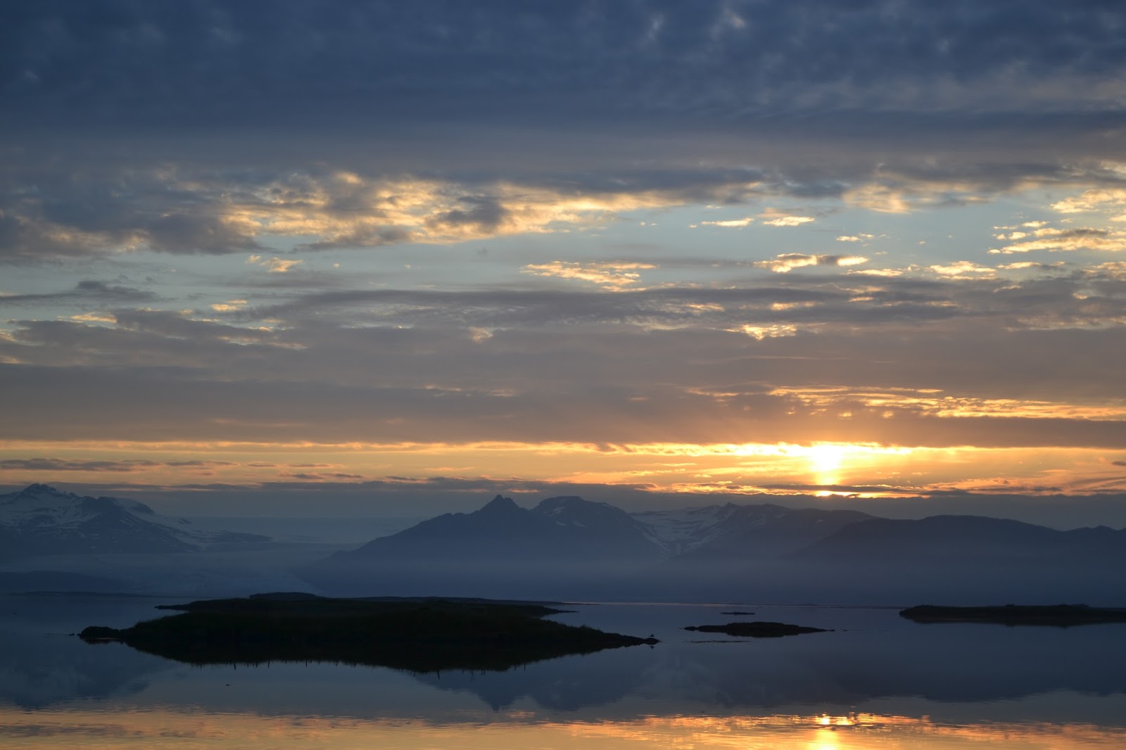
Öxnadalsheiði

It was now getting late already and I had about 120km ahead of me. The road south to rejoin the ring road was flat and easy though, and this continued well into the valley where the next mountain pass was. The rise up was so gradual and easy that one hardly noticed the elevation change, but soon I stopped to have lunch at a little spot overlooking a gorge with a fast moving stream. It was only a couple of kilometres from the top and soon the road turned down again into a very long valley. There were tall mountains on either side creating a spectacular ride, even though the wind was mostly against me all the way down. I finally got down to sea level again and turned the bend south where I caught my first glimpse of Akureyri, the capital of the North and Iceland´s largest city outside of the Reykjavík area. I arrived just in time too, because I was set to meet my relatives down in the harbour area for the concert on the Húni ship. The same group of musicians we´d seen in Isafjörður almost a week earlier had now made it to Akureyri as well! It was a fantastic show again, and since the weather was so great and it was their last show of the tour they played some extra songs and jumped into the sea once it was all done. One of their songs which led to a huge sing-a-long was "Ég er kominn heim" which translates to "I´ve come home"! I went home with my fathers cousin to take a shower and have a bite to eat before we went into town again for a night out. Akureyri is a beautiful place with stunning mountains all around, great bars and wonderful people. It was amazing also heading home at 2am with midnight sun still and all so calm and peaceful. I got to spend the night also in the same house and same room where my father stayed about 50 years earlier while he was in Akureyri for high school! 
Riding up Öxnadalsheiði with the gorge on the right
Arriving to Akureyri and with a shadow from the sunny day!
The ship Húni with the band playing on board

Rest day in Akureyri

I slept in for a long long time, as it was great to sleep in a bed for a change. There were delicious pancakes for brunch and after a little bit my fathers cousin Árni took me out for a tour of the town. He´s an amazing guy, the first thing I noticed about him was how big and strong he was unlike most other guys in the family who are lankier. We went around town and made it up also to the ski area up the mountainside where there was a beautiful view of the town. With the sun beaming down it was a wonderful sight, and the mountains in Glerárdalur where the main river through town starts, were gorgeous. I spent the afternoon at the house of my grandfathers sister, looking at old photos, trying several different Icelandic foods like Hangkjötssalat and Rúgbrauð, while other relatives stopped in as well. In the evening my fathers cousin Hallgrímur picked me up and we went to see a football match between the local club Þór (same as my name!) and Breiðablík from Kópavogur. It was an entertaining game, although the home team lost 1-2 after missing a penalty kick. Hallgrímur then showed me his workshop in town where he does his painting, and we played a game of pool and I got to meet some other artists with workspaces in the same building. All with a wonderful view of the city centre and the fjord, where apparently you could see whales last year when two whales spent the summer in Eyjarfjörður.  I was dropped off later again at Árnis house, where we had supper and a delicious rhubarb pie for dessert. Now just time to pack up and prepare for tomorrows ride to the famous lake Mývatn!
Glerárdalur with the famous Súlur mountain
Þór at the home of the football club Þór!
Hallgrímurs studio in downtown Akureyri


Thursday, July 18, 2013

Loons, Mergansers and Guillemots

Reykjanes to Hólmavik - 101 km

There was one last fjord to circumnavigate before heading across the pass at Steingrímsfjarðarhæði and I could feel the previous days distance in my legs. I stopped right at the bottom of the rise to have some lunch, and met a Dutch hitchhiker who had been waiting there for two hours. He was afraid that his stuffed pockets made him look suspicious, but he seemed like a normal Dutch guy to me! I made him try some smoked Hangikjöt that my Aunt had sent with me, and then he was off with an Icelandic family traveling in a large Nissan Patrol. The rise up across the pass was long and tough, with the landscape completely desolate, hardly even any birds up there. The way down on the other side was so crazily different though, with a sharp drop down into a narrow valley, completely green with sheep everywhere. I quickly reached the town of Hólmavík and stopped in for a hot dog. On the news they were interviewing the Icelandic women´s soccer team that had defeated the Netherlands 1-0 today in the Euro 2013! Áfram Ísland! I continued a bit further and found an incredible place along the road to camp, with a beautiful view to the west where the sun was slowly setting.
If I had to spend the night at Steingrímsfjarðarhæði, this is where I´d be
Another Icelandic delicacy, Pulsu with extra Remulaði, and an Egils Malt

Not a bad place to settle down for the night


Hólmavík to Hrútafjarðarháls - 119 km

The next morning I had breakfast on the seashore, watching the Guillemots dancing around while avoiding the stealth attacks from the Arctic Terns that were guarding their nests. There are just so many birds all over the place in Iceland. So far I´ve seen Swans, Guillemots, Eider, Puffins and many more. I got another late start as a result, not leaving until 1pm! I really need to change that and get up earlier. I next had to pass two more smaller fjords, but was surprised by the monstrously steep climbs at the end of each. On the second climb is when the rain started, and it never stopped. It followed me all the way down Hrútafjörður and chased me into the rest stop at Staðarskáli where I had a Staðarskáliborgari (cheeseburger with mushrooms, onions, bell peppers and extra cocktail sauce). The burger worked it´s wonder and I managed another quick 12 miles before finding a spot to camp along the road, definitely not as pretty as yesterday. So, a tough day but the weekend is supposed to be sunny so I´m looking forward to some better weather!
Guillemots hanging out with Drangsnes in the background
After a monstrous and unexpected 300m climb out of Kollafjörður
Had about 15 miles of this in the rain today


Wednesday, July 17, 2013

From the Diggers Gulley to the Smoky Peninsula

Leaving the Farm

I woke up early, but it took a while to get ready and I didn´t feel like I was ready to leave the farm yet. My aunt packed me some leftover potato salad and lamb meat, and away I went down the bumpy road. Until 1996 there was a pass at 720m that one had to go over to get to Ísafjörður, but has now been replaced by a 7km long tunnel. It was a bit spooky cycling there, it only has one lane, but with spots for you to wait while cars come past the other way. 
Inside the spooky tunnel

In and out of the Fjords

The rest of the afternoon was spent going in and out of several very long fjords, and it rained most of the day. It was very quiet and mostly desolate but the few farmers I´d see would wave and I´d wave back.  It was almost disheartening at times seeing cars pass me, and then within minutes see them on the other side of the fjord already while I was in the rain taking almost 10 times longer to cover the same distance.  I really liked passing through Álftafjörður (Swan Fjord) with the beautiful tall mountain at the end, and seeing a family of swans with 3 young! Throughout the ride I also had a view of Snæfjallaströnd, the barren snowy coast on the peninsula to the north where nobody lives any longer.  
Seemingly at the end of the Earth - with the North Atlantic beyond Hornstrandir 
Álftafjörður with the Swam Family

My destination for the night was the hotel and campsite at Reykjanes. The owners are two brothers who when they were young had spent some summers working at the farm with my father and grandfather, so I was looking forward to saying hello! With "Reyk" in the name there was also of course the promise of hot springs! Once leaving the fjords behind, it was much longer to Reykjanes than I had thought though, and my distance for the day was more than 96 miles and I didn´t arrive until almost midnight.  The woman at the desk opened the changing rooms and the pool for me though, so after setting up my tent I ran through the drizzle into the hot pool and soaked for about half an hour. Such an incredible feeling after about 9 hours in the saddle, looking out to the north on snow covered mountains, sitting in a pool at about 35C. Needless to say, I slept great afterwards!
The smoky hot springs from where Reykjanes gets its name
Texas trucks have nothing on Icelandic ones

Today I´m heading over Steingrímsfjarðarhæði, and will pass through Hólmavík before finding a spot to camp on the side of the road somewhere south of there.